Where we work(Guanacaste)
Architects in Papagayo
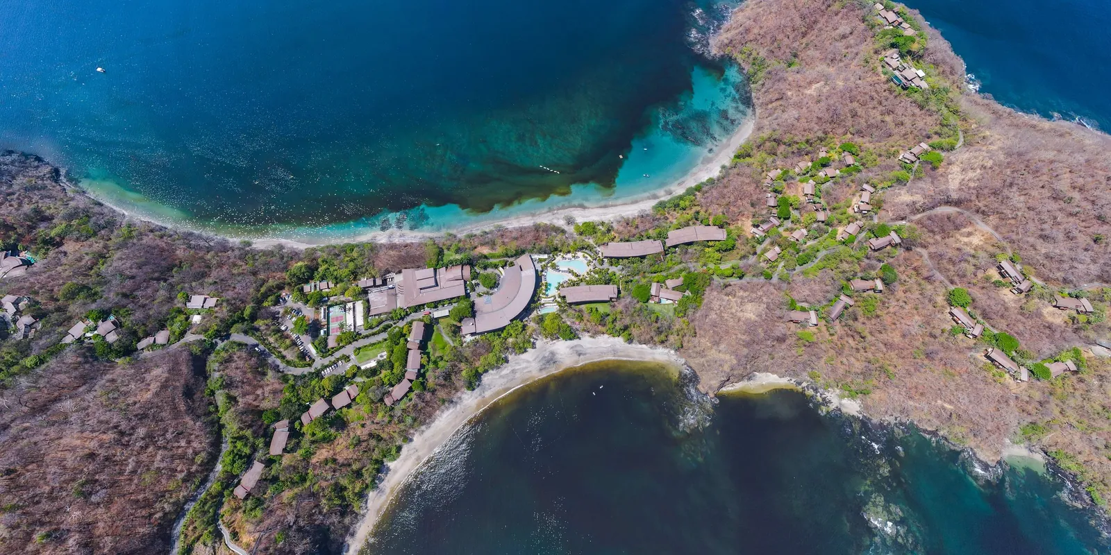
Papagayo is in the canton of Liberia, Guanacaste, 8 m above sea level. A year here brings 1,793 mm of rain, 97% of it from May to November. Permits for a lot go through the Municipalidad de Liberia.
We design houses, rental villas and small hotels in Papagayo and anywhere else in Costa Rica, from the first site visit to the CFIA permit.
(At a glance)
- Canton
- Liberia, Guanacaste
- Permits
- ICT, then the Municipalidad de Liberia
- Elevation
- 8 m
- Rain
- 1,793 mm a year
- Dry season
- December to April
- Liberia airport
- 55 min by road, 32 km
- San José airport
- 4 h 45 min by road, 238 km
- Sunlight
- 2,097 kWh/m² a year
- Solar power
- 1,690 kWh a year per kW of panels
(The year)
The dry season runs from December to April: 5 months under 60 mm of rain. The wettest month is October, with 426 mm.
July rains less than June and August: the short break known as the veranillo de San Juan.
Afternoons are hottest in April, at 34 °C on average, and coolest in November, at 30 °C. Nights stay between 23 and 26 °C.
Best time to start*
The best time to start building here is from November to March. Those 5 months bring 132 mm of rain in total; the other 7 bring 1,661 mm, 13 times as much.
Earthworks, foundations and concrete pours need dry ground, and many roads to the lots only stay passable without rain. On a day with 10 mm of rain or more, that work usually stops.
A 4-month phase of earthworks, foundations and structure that starts in November meets about 3 such days here; the same phase started in April meets about 20. Starting in November saves about 17 days of stopped work: some 2 weeks of crew and machinery paid to wait, and the pumping and drainage that wet excavations need. So the permit should be ready by October. Still, it is a recommendation, not a rule: building goes on through the rains, more slowly, and no project should sit for months waiting for the dry season.
(The wind)
Up to 7 km/h7 to 1414 to 2222 to 29Over 29
In the dry season the afternoon wind at Liberia airport comes from the northeast.
Rooms that open to the wind on one side and away from it on the other cool themselves, and a roof that sheds the rain lets them stay open in the wet months too.
(Wind and sun)
(The sun)
Each dot is the sun at a whole hour, every three days: each figure-eight is one hour across the year, and the lines are the 21st of each month. Orange and red dots are the hours when the sun should stay off the glass.
The sun here is never far from overhead. At noon it stands 79° high in March and September and 56° in December, and from April 19 to August 26 it passes north of overhead, so walls and glass that face north take sun as well.
What heats a house is the low afternoon sun. It sets at 294°, west-northwest, in June and at 246°, west-southwest, in December. That side needs the deepest roof.
Sunrise falls between 5:19 and 6:06 all year, and sunset between 17:17 and 18:09.
The ground here gets 2,097 kWh of sunlight per m² a year, and solar panels make about 1,690 kWh a year for each kW installed.
(Building here)
Building here follows its own route, set out below.
A house of 300 to 500 m² to start with: change the project and the route redraws.
The Municipalidad de Liberia issues the permit. It has a partial (1983, 2002, 2008); outside it, the national construction rules apply.21,29
-
(01) The lot and its rules
-
(02) Approvals before the drawings
-
In Península Papagayo: a pre-design meeting, the schematic and the final design, US$2,000 each, before anything else.
-
The tourism pole is an ICT : the ICT approves the schematic design and stamps the drawings.
-
-
(03) The environment
-
Not needed: under 500 m².8
Not needed
-
-
(04) Drawings and the CFIA
-
(05) Licence and works
The 50 m public zone along the beach stays public throughout the pole, and the coast here is administered by the ICT rather than the municipality 1,3.
(Permits in Papagayo)
Building in the Golfo de Papagayo tourism pole
Most of the land around Bahía Culebra, Península Papagayo included, is not private property. It is state land run by the ICT, the national tourism institute, under Ley 6758, and owners hold a concession of up to 50 years: every right of an owner except selling the land 1,2. The coast inside the pole is under the ICT as well 3.
What can be built is set by the ICT's Plan Maestro: at most 14 m high from natural ground, an average of 20 rooms per hectare counting hotel and residential rooms alike, at most 30% of the original concession built over, and no septic tanks, since every project needs a treatment plant 4. The ICT also rules on colours, earth tones on at least 90% of visible facades, and on how much each roof or paving material counts toward the 30% 5,6.
Inside Península Papagayo a private board, the Master Design Review Board (MDRB), reviews every house first, under the Master Design Guidelines 7,8.
- (01)
MDRB, in Península Papagayo
A pre-design meeting, a schematic review and a final design review. Final approval comes before the ICT, the CFIA and the municipality. Each review costs US$2,000, plus a compliance deposit of US$20,000 to US$50,000 by house size 7.
- (02)
SETENA, in parallel
Environmental viability where the project's size and site require it. The ICT asks for the SETENA file number before it stamps the drawings 2,9.
- (03)
ICT, the schematic project
The ICT's executive office approves the anteproyecto: site design, description, phases, budget and schedule 2.
- (04)
ICT, the final project
The full construction drawings, with water demand, the wastewater plant, the fire network and storm drains. The ICT must resolve a complete file within 30 calendar days and then stamps the drawings 2.
- (05)
CFIA and the municipality
Then the usual route: the CFIA's APC platform and the building permit, from the Municipalidad de Liberia on the peninsula, or from Carrillo on the Playa Panamá side 2,10.
- (06)
Build within the deadline
For residential use, the house must be built within one fifth of the concession's original term 2.
- Check the lot in the ICT's concession registry and on its concession map before buying: some boundaries and registry overlaps are under review 11.
- Since April 2026 the Constitutional Court has suspended tree-felling permits for hotel projects in the pole, and construction authorizations that used the density compensation rule, which the government repealed in June 2026. The Procuraduría has also recommended annulling the 20 rooms per hectare and 30% rules. Check where both cases stand before committing 12,13,14,16.
- Water has held projects back here before: in 2017, nine concessions were stalled for lack of a water availability letter. Inside Península Papagayo the resort operator supplies water, with a US$25,000 connection fee 7,15.
- Every transfer or mortgage of a concession needs the ICT board's approval 1,2.
- Ley 6758, Regula la ejecución del Proyecto Turístico de Papagayo. SINALEVI, 1982.
- Decreto Ejecutivo 25439-MP-TUR, Reglamento a la Ley 6758 (current text, with its annex). SINALEVI, 1996, reformed 2026.
- Ley 6043, Ley sobre la Zona Marítimo Terrestre, article 74. SINALEVI, 1977.
- Plan Maestro General del Polo Turístico Golfo de Papagayo (current text). ICT, via SINALEVI, 1995, reformed 2012.
- Acuerdo SJD-142-2023, exterior colours. ICT, via SINALEVI, 2023.
- Acuerdo SJD-385-2020, how materials count toward coverage. ICT, via SINALEVI, 2020.
- Península Papagayo Master Design Guidelines. Península Papagayo, November 2023.
- Master Declaration for the Península Papagayo resort community. La Gaceta 158, via SINALEVI, 2004.
- Decreto 43898-MINAE-S-MOPT-MAG-MEIC, environmental impact assessment regulation. SINALEVI, 2022.
- SETENA confirma viabilidad ambiental de proyecto en Papagayo. La Nación, 23 March 2026.
- Mapa mosaico de concesiones del PTGP. ICT, current.
- Medidas cautelares en el Polo Turístico Golfo de Papagayo. Sala Constitucional, 17 April 2026.
- Sala IV aclara alcance de la suspensión de construcciones en Papagayo. Delfino, 6 May 2026.
- Procuraduría señala como inconstitucionales dos normas de construcción en el Polo Turístico Papagayo. Delfino, 5 March 2026.
- Agua pone en riesgo proyectos hoteleros en Costa Rica. Revista EyN, 17 March 2017.
- Decreto 45823-MP, repeal of density compensation. SINALEVI, June 2026.
(Our work nearby)
(Questions)
When is the best time to start building in Papagayo?
Ideally from November to March, so that the earthworks, foundations and structure fall in the dry season. A 4-month phase of that work started in November loses about 3 days to heavy rain, against about 20 if it starts in April, about 17 days of crew and machinery. It is a recommendation, not a rule: building goes on through the rains, more slowly, and no project should sit for months waiting for the dry season. To start then, have the permit ready by October.
Who issues building permits in Papagayo?
Several bodies, in order. Inside Península Papagayo the Master Design Review Board approves the design first; then the ICT approves the schematic and the final project and stamps the drawings; then the CFIA and the Municipalidad de Liberia (or Carrillo, on the Playa Panamá side) issue the usual permits. SETENA's environmental review runs in parallel.
Can I build near the beach in Papagayo?
The 50 m public zone stays public, and the land behind it is held under ICT concessions rather than municipal ones. What each lot allows is set by the ICT's Plan Maestro and, in Península Papagayo, by the lot's diagram in the design guidelines.
How hot does it get in Papagayo?
Afternoons average 34 °C in April, the hottest month, and 30 °C in November. Nights stay between 23 and 26 °C. Shade on the west side and air moving through the rooms do more for comfort than anything else.
How far is Papagayo from the airports?
By road, without traffic, 55 min from Daniel Oduber airport in Liberia (32 km) and 4 h 45 min from Juan Santamaría airport in San José (238 km).
Rain: CHIRPS climatology (CHPclim v2, Climate Hazards Center, UC Santa Barbara). Temperature and wind: measured at Liberia airport, 15 km away, typical year 2011 to 2025 (Climate.OneBuilding.org TMYx, from NOAA observations), temperatures adjusted for elevation. Heavy-rain days: NASA POWER (MERRA-2), 2001 to 2020. Sun: calculated for the town's coordinates. Elevation: SRTM. Roads and places: OpenStreetMap. Gathered October 2026.